Apparently things are moving along.
http://www.bv.com.au/change-the-world/42133/
New state guidelines have been issued by the Dept. of Transport in Oct 2010. http://media.bv.com.au:8080/file/file/VTP%20Cycling%20Strategy_Guidelines.pdf
The document is aimed at the major culprits - road builders and managers - and argues for full consideration of bicycle facilities in future road planning and building. Even along major roads, like in Copenhagen.
I don't see anything here about fixing up the crap cycle lanes that are incomplete or dangerous, however. And builders can get out of building new facilities by claiming they are unecessary or unsuitable for the location. So the policy is welcome but needs to be tested.
contact: Department of Transport, Sustainable and Active Transport Policy, walkingandcycling "at" transport.vic.gov.au
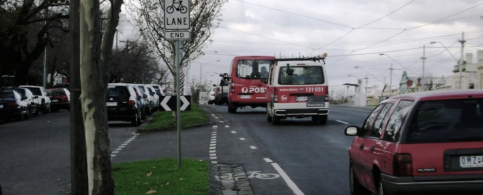
Crap cycle lanes of Melbourne The Warrington Cycle Campaign in the UK produced "Crap Cycle Lanes: 50 Worst Cycle Lanes in Britain" (Eye Books, 2007). It documents how bad transport infrastructure often lets down or endangers cyclists. This blog provides some similar cases of misplaced investment and neglect from around Melbourne, VIC, Australia. Let's actually get workmen on site rather than producing 'cycling strategies'. You have to laugh (otherwise you would cry)
Wednesday 10 November 2010
Monday 23 August 2010
BETS - Bicycle Emissions Trading Scheme
Bicycle Based Emissions Trading proposal from Dr Paul Mulvaney, University of Melbourne.
Saturday 21 August 2010
Research corner
Wearing A Helmet Puts Cyclists At Risk, Suggests Research ScienceDaily (Sep. 13, 2006). Dr Ian Walker's research in Bath, UK. Wear a helmet and drivers pass you closer. Are you listening, Bicycle Victoria?
See also research on helmets collected here - an interesting range of studies
- ABC radio broadcast on helmet laws on 21 Sept '10
- A Virtuous Cycle: Safety In Numbers For Bicycle Riders ScienceDaily (Sep. 7, 2008) Dr Chris Rissel, Sydney Uni says "We should create a cycling friendly environment and accentuate cycling's positives rather than stress negatives with 'safety campaigns' that focus on cyclists without addressing drivers and road conditions. Reminding people of injury rates and risks, to wear helmets and reflective visible clothes has the unintended effect of reinforcing fears of cycling which discourages people from cycling." Motorists seem to change their behaviour and drive more safely when they see more cyclists and pedestrians around.
- Major review article here Pucher J, J Dill and S Handy.2010. Infrastructure, Programs and Policies to Increase Bicycling: An International Review," Preventive Medicine, Vol. 50, No. S1, January 2010, pp S106-S125 Click here for PDF.
Cycle Resource Centre from the Australian National Cycling Strategy 2005-10, Australia
Sunday 15 August 2010
News from Waltham Forest
Bad infrastructure in the London suburbs
http://crapwalthamforest.blogspot.com/2009/03/absolutely-fabulous.html
http://crapwalthamforest.blogspot.com/2009/03/absolutely-fabulous.html
Tuesday 3 August 2010
Traffic modelling
Actually, traffic modelling is pretty boring for cyclists, since we generally breeze past traffic jams or avoid them. This posting from Youtube and showing www.bicyclecouncil.org (the Dutch Center of expertise on bicycle policy) models of the effects of 10% increases, and 10% decreases, in bike traffic in a city.
On the left, a 10% decline in cycling rates over the next 10 years vis-à-vis, on the right, a 10% increase in cycling.
Check it http://sexify.wordpress.com/2010/07/13/the-bicycle-as-cure-for-traffic/
On the left, a 10% decline in cycling rates over the next 10 years vis-à-vis, on the right, a 10% increase in cycling.
Check it http://sexify.wordpress.com/2010/07/13/the-bicycle-as-cure-for-traffic/
Monday 21 June 2010
Queen's Parade, Clifton Hill

 Location: Queen's Parade Clifton Hill, between Delbridge and Grant Streets.
 Council: City of Yarra, although this may also involve VicRoads or Dept.Transport. Unsure.
Responsibility: There are a large number of possibilities. Try starting with MD
The Problem: There you are, slogging north-east uphill to escape the city fumes, on a nice wide Queen's Parade cycle lane, up to the the Clifton Hill shops. OK half of the lane becomes unrideable bluestone. Suddenly, the cycle lane disappears. No signage, no explanation. Traffic roars behind you, now with impunity. You can carry straight on, ignoring the bluestong gutter that tales up most of the lane and launching onto the unmarked tarmac ahead - unmarked except for the remnants of the old dashed cycle lane that was once there, that is. Most cyclists do this.
The others veer left onto the safer access lane, pictured. There, you trundle on, veer right again, until the lane starts up again, 60m further on.You need to do that to get to the traffic lights.
This an extraordinarily crap solution to road sharing.
Solution: All that bluestone gutting and grass could house a lane you could actually ride on. But that would cost more money. So let's just leave it to cyclist's intuition, shall we? How about some signage at least?
View Larger Map
Swanston Street/Faraday Street, Carlton

 Location: Corner of Faraday St and Swanston St, Carlton.
Responsibility:
Council: Melbourne City Council
 Description: Approaching the busy Swanston Street near the University of Melbourne from the east, travelling down Faraday Street, you encounter this strange bit of green cycle lane just a few metres long. Nobody I know has any idea what you are supposed to do when you reach the end of it, and it seems to serve no purpose (I noticed the photo shows a sign, in the second photo-it has taken me 3 yrs to notice that!). There is a cycle lane on the road, which was painted in a bit later. Had you wanted to turn left, there is a clear marking on the road to do just that. Should you want to progress across Swanston Street to the University, on what is rather unfortunately called "Monash Road", there is a nice wide track to do that, after a large gap and a crossing. You might as well stay on the road to do that, too. So maybe there is a hyperdimensional portal at the end of the green lane. That would explain why you never see anybody using this crap cycle lane.They just disappear.
 Solution: Why not just leave it there as a monument to Melburnian infrastructural puzzlement?
Tuesday 15 June 2010
Gardiners Creek Trail between Glenferrie Rd and the Yarra Trail
(incomplete - not ridden it)
Location: Gardiner's Creek Trail, Boroondara and Stonnington Council
Responsibility: VIC Roads and local councils
Problem: See here for the problem. http://boroondarabug.org/wiki/Gardiners_Creek_Trail_-_two_problems. In addition, this site has substantial information and sugegstions for further improvements along the longer trail length. The conclusion is that Boroondara council has done a far better job of making a sensible and useable trail than Stonnington.
Solution: see above site. "If only we could Boroondara-ise the whole trail…"
Gipps Street, Abbotsford
Location: Gipps Street, Abbotsford
Responsibility: Yarra City Council
The Problem: Volumes have been written about the "Gipps Street Steps" on the Capital City Trail along the Yarra. Following the River path southward, it ends in steps before crossing the river east-west at Gipps Street. They are three flights of steps up that mar a pleasant commuter and leisure route (Bicycle Victoria image). They leave you winded and annoyed (on a bike or with a pram) or stranded (if you can't make it up or down).
 The Solution: In 2009 it was reported that there is finally some action on a new bridge design, pushed by Bicycle Victoria. Then on 5 May 2010, BV reported that the state budget had allowed $2.5m for a complete redesign and solution, funded through the Parks Asset and Replacement Program (Parks Victoria).
The details are here. Nice one.
For the next few months, or maybe over a year, keep slogging...
Responsibility: Yarra City Council
The Problem: Volumes have been written about the "Gipps Street Steps" on the Capital City Trail along the Yarra. Following the River path southward, it ends in steps before crossing the river east-west at Gipps Street. They are three flights of steps up that mar a pleasant commuter and leisure route (Bicycle Victoria image). They leave you winded and annoyed (on a bike or with a pram) or stranded (if you can't make it up or down).
The details are here. Nice one.
For the next few months, or maybe over a year, keep slogging...
Sunday 30 May 2010
Steep path at Hall Reserve, Capital City Trail
Location: Merri Creek Trail/Capital City Trail, under Heidelberg Rd, Clifton Hill, Melbourne
Local Council: Yarra Council; Melbourne Water must be consulted about any works under the bridge.
Responsibility: Yarra Council. Try Mark Kulyk was the contact person for the Bike Strategy of the council, 2010, but has moved on. You might try MD who works on bike pathsLocal Council: Yarra Council; Melbourne Water must be consulted about any works under the bridge.

Only the fit and those with gears can make it up. For everybody else it is get off and walk. For those with toddlers or prams it is a nightmare. Wheelchair, no chance. Coming down, you need very good brakes.
If this has not been enough, in early 2010 Yarra Council made things considerably worse by re-routing the paths at the top of the hill in Halls Reserve, adding another half a meter to the distance you have to climb at the top of the hill (see last photo below). We understand what they were doing but this was tackling the wrong issue first. They were carrying out path realignments suggested in the the Merri Creek Trail Review of 2007 but have made things worse for cyclists going up and down the hill. That earlier document, by the way, makes no suggestions about fixing the steep slope, other than to suggest cyclists dismount going down, with signs to that effect (we all ignore them). It also recommended a barrier at the top to slow downward cyclists. That would be really great if you were struggling uphill, wouldn't it? (there used to be one-it was removed).

Solution: Simply telling people to dismount is sloppy bike planning. Regrade the path. No barriers. A switchback is one solution. Simply flattening the slope a bit, at the top, would do. Is this prioritised in the Yarra Bicycle Strategy 2010-2015? No. I am not convinced the author of that document ever rode this path, which is an essential city trail - hence its name. There are vague statements in the Strategy about the difficulties of fixing paths that are not up to code, but no plans to actually spend any money.
View Larger Map


Subscribe to:
Posts (Atom)